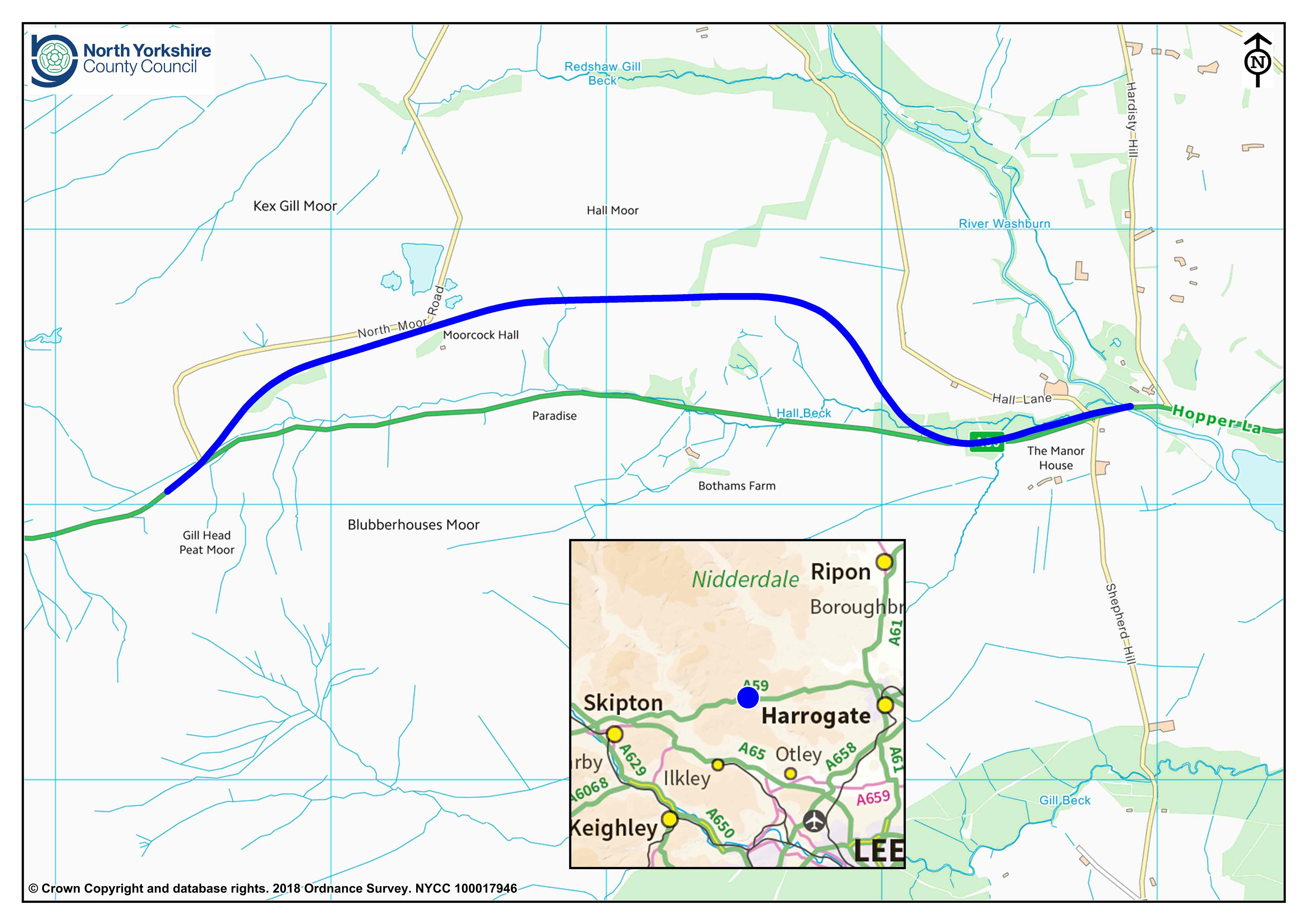
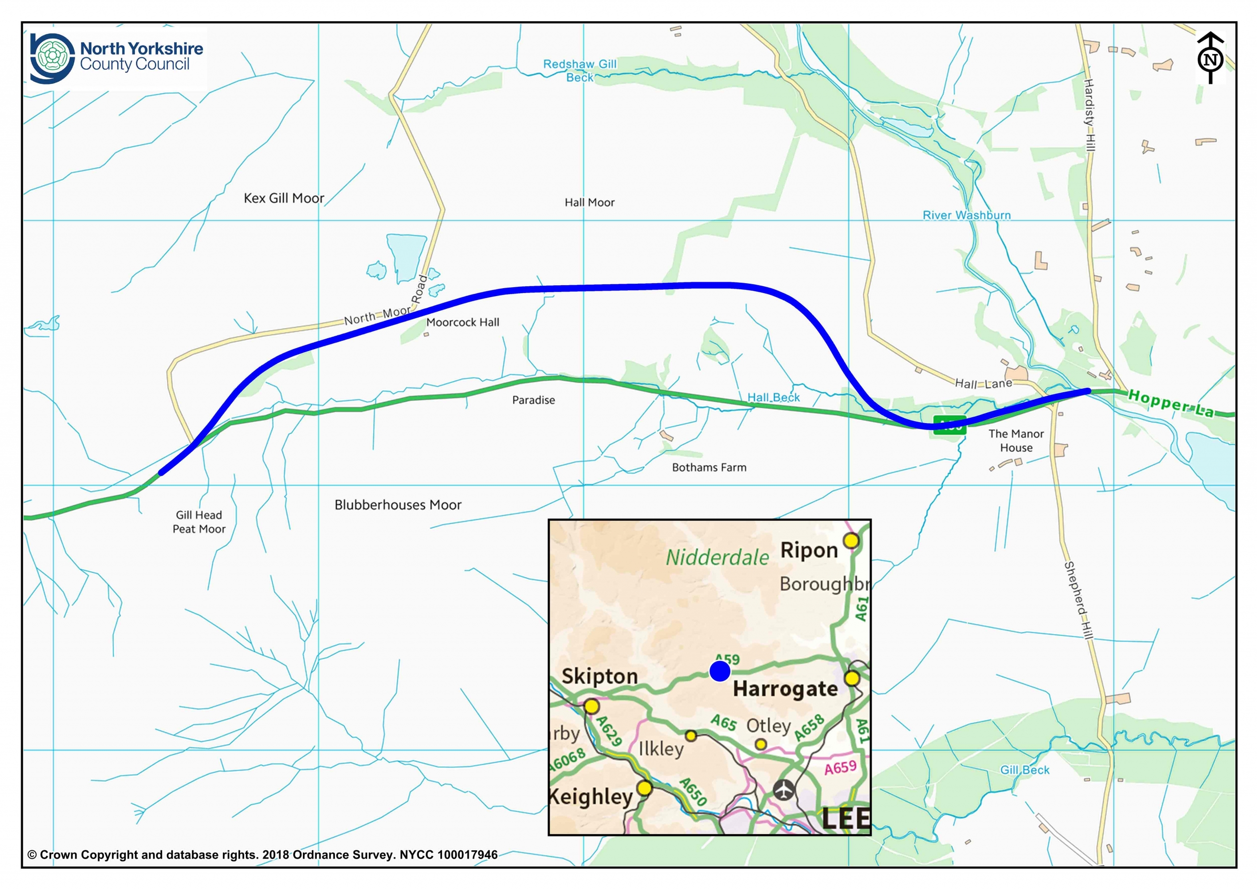
North Yorkshire County Council’s Executive will be asked to adopt the proposed preferred route for the realignment of the A59 at Kex Gill when it meets on Tuesday, 24 July.
The A59 is an important trans-Pennine route between Skipton and Harrogate, but there is a history of instability in land above the road west of Blubberhouses at Kex Gill. In May, the road was closed following instability below the carriageway and is currently open under traffic light control.
Realigning the route to the other side of the valley is part of the County Council’s plan to improve east to west transport connections. In a public consultation last year, more than 90 per cent of respondents supported the need to realign the route. A further local consultation, which ended on 12 July, enabled people to view and comment on the proposed preferred route. Again, this showed strong support for the realignment.
Click on image to see larger version

County Councillor Don Mackenzie, Executive Member for Access, said:
The Executive is being asked to adopt a preferred route for the realignment. At this stage, there is not a detailed design, simply a preferred line for the road. The Executive’s approval would open the way for County Council officers and our consultants, WSP, to proceed with detailed designs and to begin formal negotiations with landowners and partners.
We had strong support for the scheme through the consultations, during which two main concerns were raised. These are the need to minimise the impact on local public rights of way, maintaining a cohesive network that is enjoyable to use, and to treat the landscape sympathetically. Meeting these concerns will be among our priorities.
The A59 at Kex Gill passes through the Nidderdale Area of Outstanding Natural Beauty and the landscape is highly valued for recreation. The landscape also supports protected habitats and species and is designated as a nature conservation site at an international, national and local level.
The proposed preferred alignment has been developed taking into account the need to avoid areas shown by ground investigations to be unstable or potentially unstable, balanced with the need to avoid protected landscape. The alignment would run along the northern slope of the gill. It would be a 5.4km-long single carriageway incorporating climbing lanes for slow-moving vehicles.
To make the most of potential government funding opportunities, development of the scheme, which would normally take about six years, is being accelerated to take three years. Subject to the Executive’s decision on Tuesday, a full business case for funding will be produced for submission to the Department for Transport. It is anticipated construction could start in the financial year 2019/20 and the road could take 14 months to complete.


